Quick summary
- Garibaldi Lake's water is a strong turquoise blue, the effect glacier-fed lakes produce when fine rock sediment stays suspended and scatters light.
- A wall of volcanic rock called the Barrier holds Garibaldi Lake in its basin instead of letting the water drain down the valley.
- The Black Tusk, an eroded volcanic pinnacle, stands about 4 km from the lake, close enough for the flight to show both together.
- There is no road to Garibaldi Lake and the only ground route is a long uphill hike from Rubble Creek. The seaplane reaches it by air instead.
A turquoise lake in the Coast Mountains
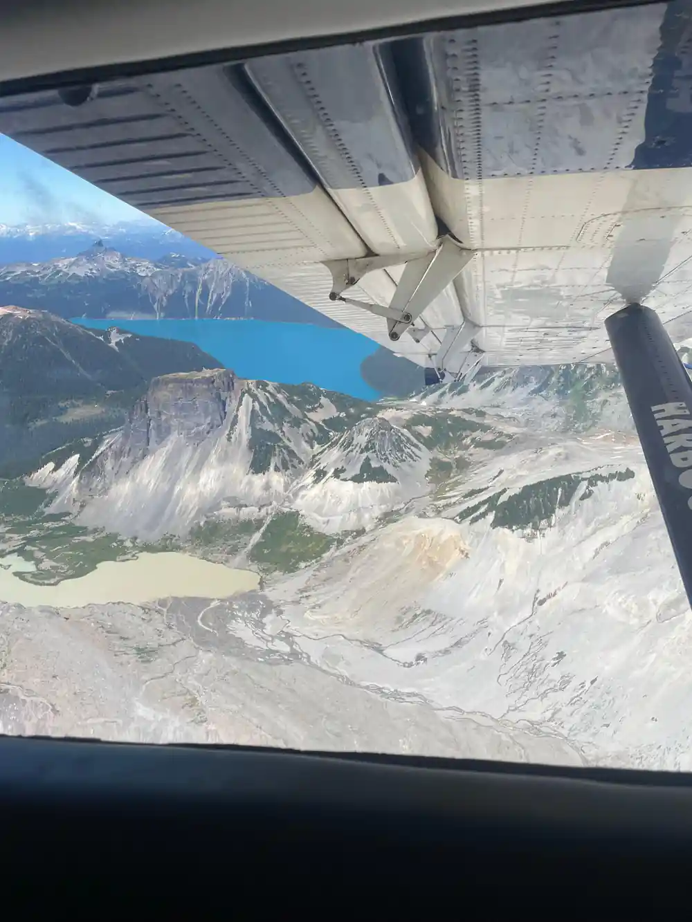
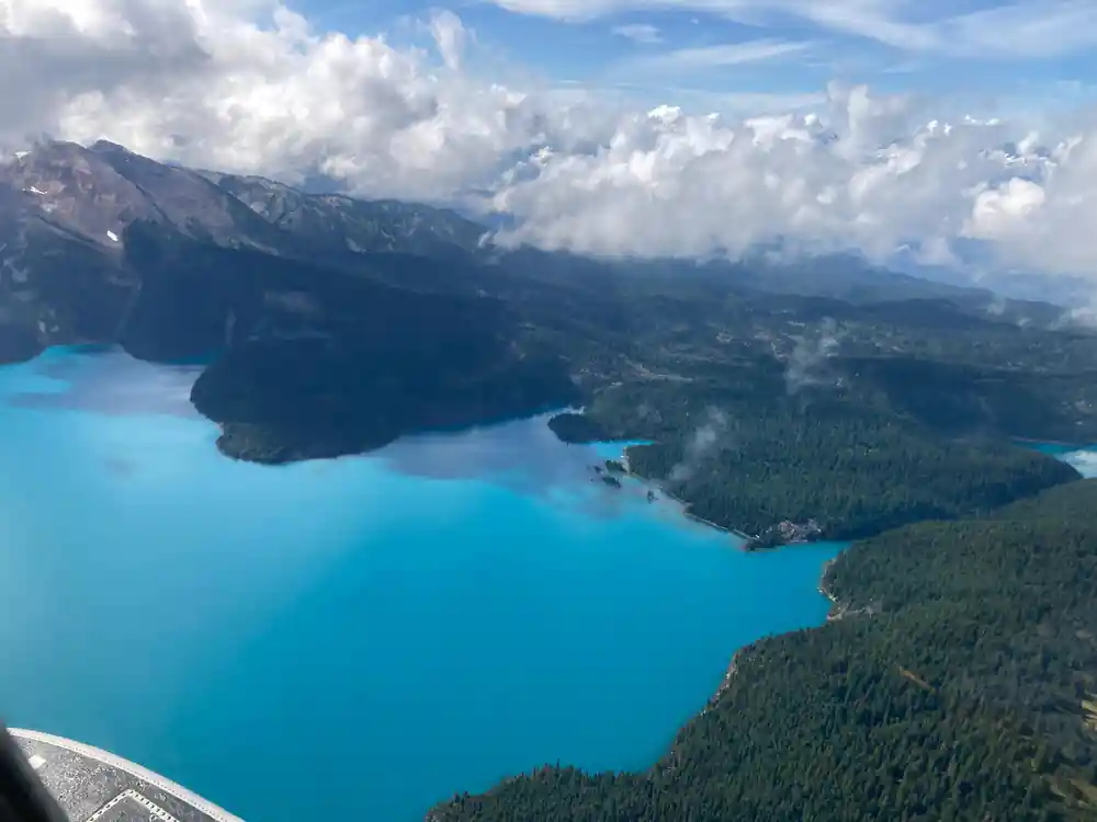
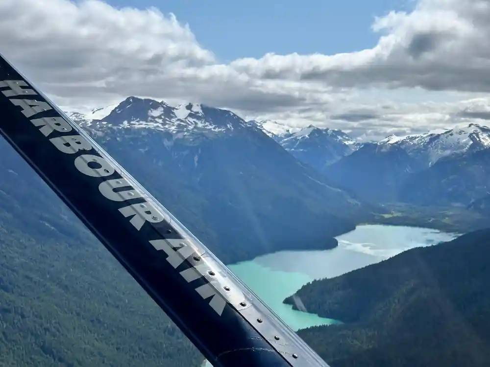
Garibaldi Lake sits inside Garibaldi Provincial Park, in the Coast Mountains of British Columbia. From the air on the Whistler seaplane flight, it appears as a wide sheet of strong turquoise water set into a basin of grey rock and green forest. The colour is immediate and obvious even at altitude, the kind of blue that looks retouched in photographs and is not.
The lake is held in its basin by a wall of volcanic rock known as the Barrier, which runs along one side and keeps the water contained rather than draining freely down the valley. Seen from a floatplane banking over the park, the Barrier reads as a dark, straight-edged ridge against the pale water, a piece of geology doing a very specific job.
Why the water is that colour
Glacier-fed lakes get much of their colour from something called rock flour: fine sediment ground off rock by moving ice, so fine it never settles and stays suspended in the water instead. Light passing through the lake hits those particles and scatters, and the wavelengths that scatter back toward your eye read as blue and green rather than the brown or grey of an ordinary mountain lake.
Garibaldi Lake sits among glaciated peaks in the Coast Mountains, which is the setting that produces this effect elsewhere in the world too. It is a matter of physics rather than a quirk of one lake, which is part of why the colour holds up so consistently in photographs taken from very different angles and altitudes.
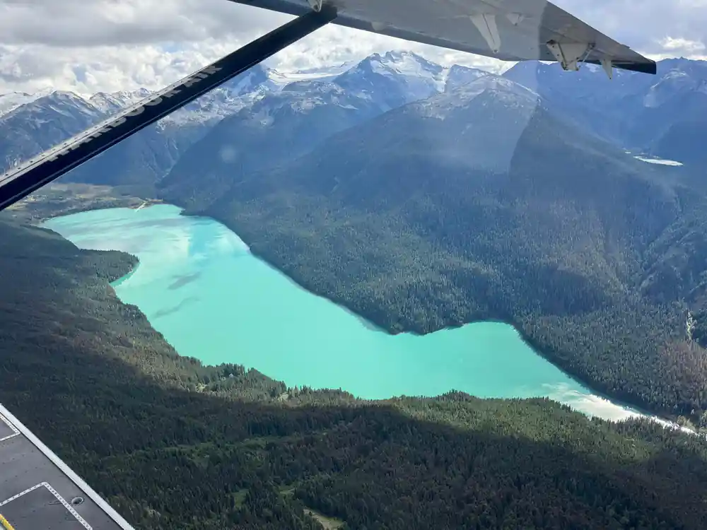
Garibaldi Lake's turquoise water held behind the Barrier's volcanic wall.
The Barrier, and what it holds back
The Barrier is a wall of volcanic rock along the edge of the Garibaldi Lake basin. It stands as the feature that keeps the lake where it is, rather than letting the water find its own way downhill through the valley below. A lava flow that blocks a valley can act as a natural dam once the rock cools, and a basin fills in behind it in much the same way a lake collects behind any wall built for that purpose.
From the ground, the Barrier is something hikers walk beneath. From the air, it is something you fly past and look down into, the full shape of the wall visible at once next to the lake it holds, with the pattern of rock and water laid out together rather than seen one piece at a time.
The Black Tusk, close enough to frame together
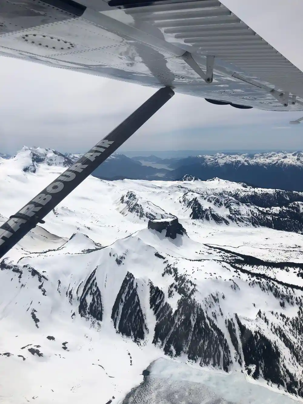
The Black Tusk stands about 4 km from Garibaldi Lake, close enough that a seaplane circling one can put the other in the same view. It is a dark, steep-sided pinnacle of volcanic rock, the eroded remnant of an old volcano, and it is visible from a long stretch of the Sea to Sky corridor on a clear day, even from the ground.
From the air, the Tusk's dark rock stands out hard against the pale sky and the turquoise lake beside it. The two features read as a matched pair from altitude: one is a body of blue water in a rock basin, the other is a black spike rising well above the treeline nearby, and the flight's loop is built to show both.
4 km
Garibaldi Lake and the Black Tusk sit about 4 km apart, close enough for one flight to frame both together.
Getting there without the trail
There is no road to Garibaldi Lake. On the ground, reaching it means a long uphill hike from the Rubble Creek trailhead, on foot the whole way, with no shortcut and no vehicle access at any point along the route.
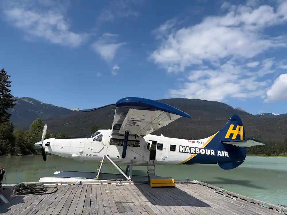
The seaplane flight covers the same ground differently. It takes off from Green Lake at the Harbour Air terminal in Whistler, flies out to Garibaldi Lake and the Black Tusk, and lands back on the water it left from about 30 minutes later. The terminal sits roughly 24 km from the lake in a straight line, the distance the flight actually travels rather than a road or trail measurement. It is a sightseeing trip built around this view rather than a transfer to anywhere else.
What the basin looks like laid out below you
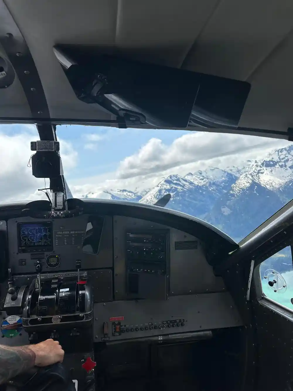
From a hiking trail, Garibaldi Lake is seen a piece at a time: a stretch of shoreline here, a view across the water there. From a small floatplane, the whole basin resolves at once, the turquoise lake, the dark line of the Barrier, and the black shape of the Tusk all visible together against the glaciated peaks around them.
The flight is a loop rather than a transfer. It takes off from Green Lake, shows you the lake and the Tusk from altitude, and returns to the same water in Whistler, which means the whole comparison, ground route against air route, plays out in one short outing rather than a full day's walk.
The peaks that ring the basin
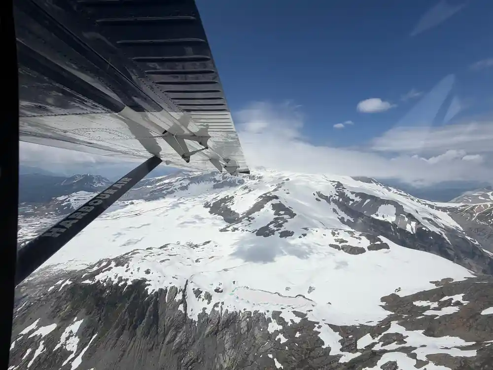
Garibaldi Lake sits inside a wider basin ringed by glaciated peaks in the Coast Mountains, terrain that turns the aerial loop into more than a look at one lake. The Black Tusk is only the most distinctive of the summits nearby. The ridgelines and snowfields around the lake are part of the same view, visible together rather than one at a time the way a single trail viewpoint would show them.
That wider view is also the honest answer to how large Garibaldi Lake actually looks: a single lakeside vantage point shows a stretch of shoreline, not the whole basin. From the air, the shoreline, the Barrier and the surrounding peaks resolve into one continuous shape, closer to how large the lake actually reads than any photograph taken standing at its edge.
See Garibaldi Lake and the Barrier From the Air
from US$207Reserve now & pay later